- Address
- Length:
- 29KM
- Width:
- N/A
- Surface:
- Water
- Running Slope:
- N/A
- Cross Slope:
- N/A
Trail Description:
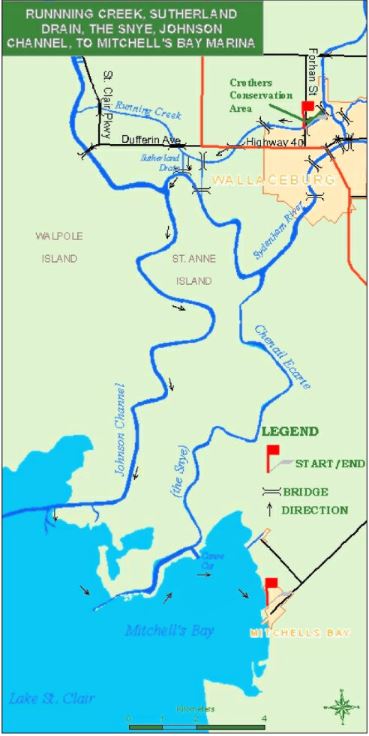
This route starts at the launch area at the west end of Crother's Park and follows Running Creek and the Sutherland Drain to Johnson Channel. This distributary is one of several channels that cut through the St. Clair delta to Lake St. Clair. The Johnson runs through First Nations territory and exhibits a wide diversity of shoreline plants and waterfowl. If the wind and waves make the lake risky, canoes and kayaks can cut through the marsh from the last bend in the Johnson towards Canoe Cut and then travel to Bass Haven, north of Mitchell's Bay. This route is 29km (18 miles) long.
A portable washroom will be made available to users from April 1st- October 30th. The washroom is available at the Crothers Park Parking Lot. Should the washroom become vandalized it may be removed.
- Washrooms
- Parking
- Pets
- fishing
- nature
- birding